Implementing SS3D support for bathymetry is futile because it wasn't designed for that!
The problem is that the sensor doesn't have a built-in INS, and the SL3 format doesn't store any roll, pitch, or heave data. Post-processing from SL3 is impossible. The only option is to record navigation data in a separate file and then synchronize it... and Reefmaster doesn't have a Patch Test function because it's not designed for post-processing MBES data.
Professional hydrographic software SonarWiz has implemented SS3D support, but it doesn't...
So maybe in the future, it would be better to implement support for a simple commercial multibeam echosounder and Patch Test?
100% agree. It's not impossible, but you need to record and synchronise extermal IMU data to make it worthwhile. Any sort of pitch or roll, even of small magnitude, makes the data more or less useless without correction. Given this and the fact that the SS3D module is discontinued means that for us it isn't worth the effort - meaning, would it provide enough extra revenue to be worth the considerable investment (almost certainly not). There are some third party tools that I am aware of that attempt to perform these corrections, so the best course of action is to use one of those and import corrected data into RM.
The administrator has disabled public write access.
Yep - still on course for beta shortly and full release probably June(ish). I will try and get some screenshots up here soon to give an idea of what is changing (and what isn't).
The administrator has disabled public write access.
Yep - still on course for beta shortly and full release probably June(ish). I will try and get some screenshots up here soon to give an idea of what is changing (and what isn't).
disk.yandex.ru/d/2_Cjwt-vPNtQYg
Here are some logs from my Garmin Panoptics PS70 sensor. It might have more than just 2D sonar.
Maybe it has RealVü 3D and LiveVü or Triple-Beam.
Maybe there is some data from a multibeam sonar, so that it can then be used to build maps directly from the recording log, rather than extracting data from an interpolated quickdraw
The administrator has disabled public write access.
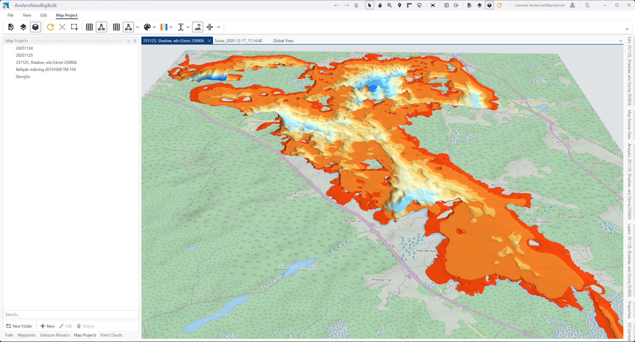
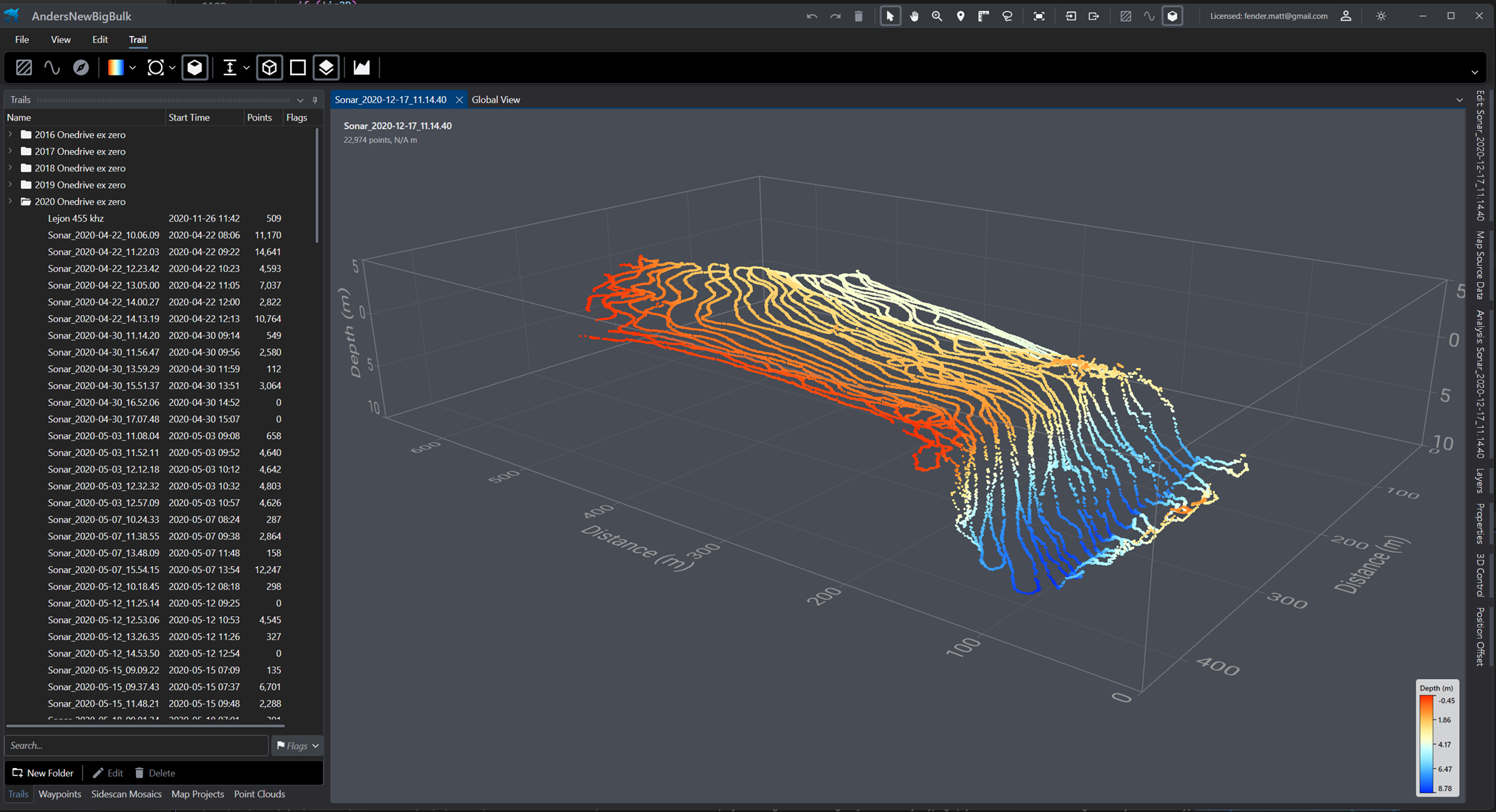
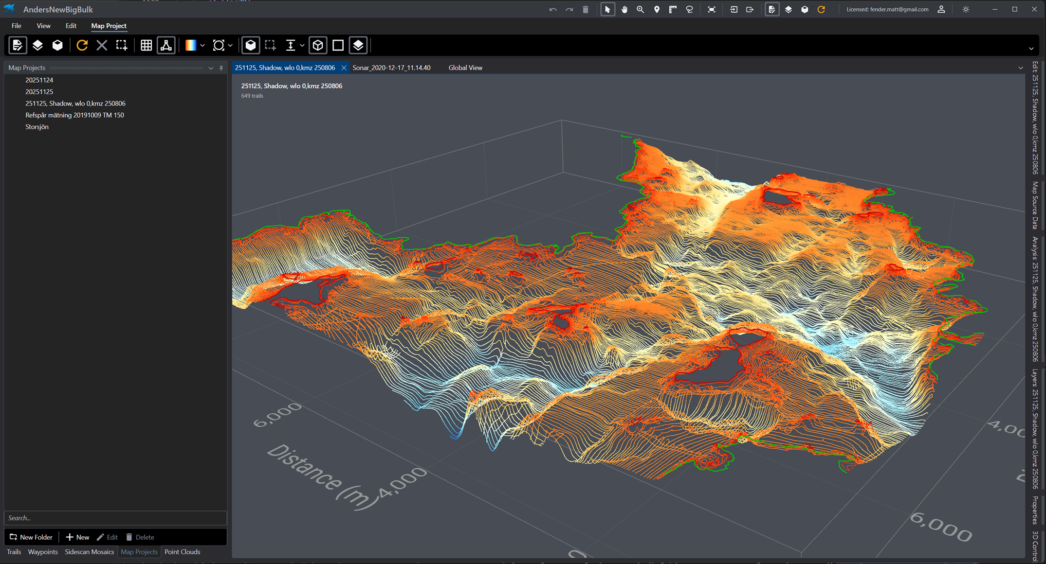
It's coming! Still some loose ends to tie up, but a few screen grabs below to give an idea. This is a big release - moving from .NET Framework to a new tech stack, .NET 10 and Avalonia 12 which is cross platform. We are building and testing under Windows, MacOS and Linux and will be releasing native versions for all (starting with Windows).
A few key updates:
Full vector mode map generation (in addition to the existing triangulate/rasterize solution). This produces a mesh that retains original positions, original shoreline etc.
Additional map gen interpolation algorithms Natural Neighbour and IDW. Former in particular is a nice alternative to triangle facet, providing reasonable continuous surface whilst preserving original data points in the finished mesh.
Updated 3D view now with full resolution possible in both vector and raster modes, transects, 3D export formats including STL for 3D printing :)
3D view and editing of trail points in trail and map view - really useful for finding bad data points.
Delay load of all heavy data - some big workspace load times are down from 5 minutes to under 10 seconds.
..and lot's more including full Shapefile attribute editing and value mapping from vector layers, world tides integration, fully reworked sonar analysis with plugin architecture (write your own analyser!) and much more..
..oh yes and dark mode :)
The administrator has disabled public write access.