Waypoint Manager/Sonar Viewer for Lowrance
The ReefMaster Waypoint Manager/Sonar Viewer for Lowrance is a Windows application designed specifically to work with data from Lowrance sonar units.
This easy-to-use program includes waypoint, trail and route management along with a multi-channel sonar viewer. Previously tedious tasks, such as updating waypoint icons or labels, or removing duplicate waypoints, can be completed in seconds with a minimum of effort.
- Display, edit and manage waypoints with full equivalent Lowrance icon and colour sets.
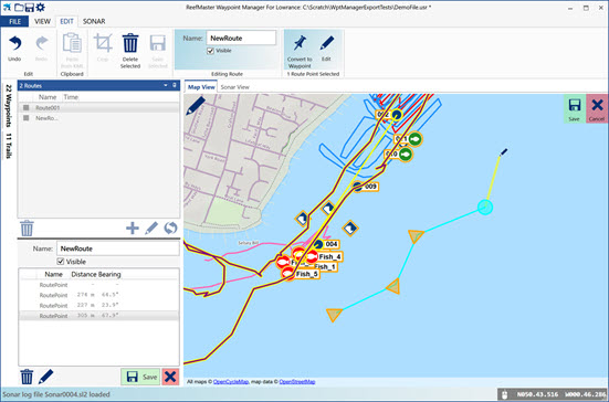
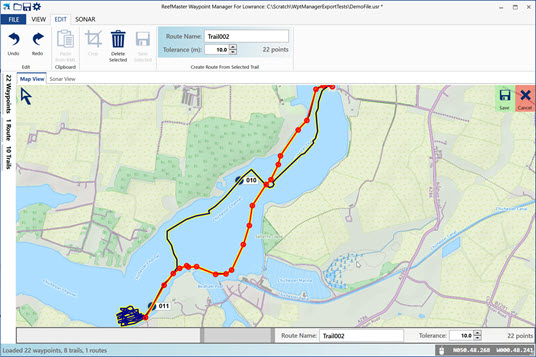
- Display, edit and manage routes and trails, convert trails to routes and convert route-points to waypoints.
- Easily select groups of waypoints, trails or routes for export, editing or deletion.
- Group editing operations on waypoints and trails, including icon and colour, label visibility and more.
- Import export of Lowrance USR file format in versions 3/4/5/6, Google Earth, GPX and CSV file formats. Quickly and easily convert one file type to any other.
- Copy and paste trails and waypoints directly from Google Earth.
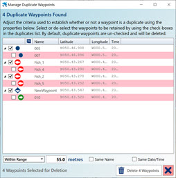
- Simple to use waypoint duplicate-removal tool.
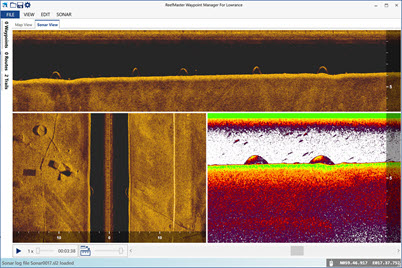
- Full multi-channel sonar viewer for Lowrance SLG, SL2 and SL3 sonar log files.
- Metric or US units.
Features
Waypoint Management
- View, edit and manage waypoints with full equivalent Lowrance icon and colour sets, and all available Lowrance waypoint attributes, including alarm radius, depth and description.
- Bulk editing of any waypoint attribute. Groups of waypoints can be selected in the map or list views, and waypoints can be sorted by a range of criteria, including symbol, name, time, latitude or longitude.
- Group delete or export of selected waypoints, making it extremely easy to export waypoints from a specified region to a new data file.
- Manage waypoint duplicates with our easy-to-use duplicate removal tool. Remove waypoints with exactly the same locations, or within a specified range, with or without the same name or time of creation.
- Import waypoints from Lowrance USR files, preserving internal Lowrance IDs, or from Google Earth (KML), GPX or text files.
- Copy and paste waypoints directly from Google Earth.
Trail Management
- View and edit Lowrance trails with the full Lowrance colour set.
- Split trails composed of multiple recording segments into individual trails, allowing each to be edited separately.
- Convert trails to routes, with adjustable trail simplification so you can generate routes with just as many route points as you need.
- Bulk editing, delete or export.
- Copy and paste trails directly from Google Earth.
Route Management
- Graphical route editing.
- Create routes by hand or using a list of waypoints.
- Quickly convert trails, or parts of trails, to routes, with adjustable simplification level.
- Convert route points to waypoints, singly or in bulk.
Sonar Viewer
- Multi channel sonar viewer supports Lowrance SLG, SL2 and SL3 sonar file formats.
- View all recorded channels, together or in any combination, with flexible sonar channel layout.
- Take waypoints in 2D or sidescan channel views.
- Fast playback up to 30x speed.
- View sonar side-by-side with map view, or in a full window.
- Take high resolution image snapshots to the clipboard.
- Measure distance in any channel view and or estimate object height in the sidescan channel view.
- A range of 2D and sidescan colour palettes, with adjustable brightness and contrast.


